WEATHER IN EL CHALTÉN
You’ve probably heard the saying: “In Patagonia, you can experience all four seasons in a single day” — and honestly, it couldn’t be more true. You might set off in the morning under bright sunshine with a pleasant temperature, only to watch a few clouds roll in by midday along with that notorious companion (the one that blows very hard). By the afternoon, a few drops of rain start to fall and the temperature drops sharply — though chances are, just as you keep walking, you’ll start to feel warm again as the sun bursts back out of nowhere.
So if you’re planning a visit to El Chaltén or anywhere else in Patagonia, come prepared for anything — and that rule applies no matter what time of year you’re travelling.
Table of Contents
A Few Things to Keep in Mind
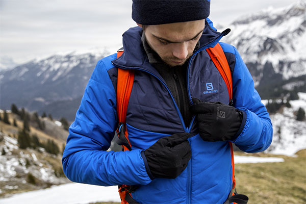
If there’s one thing that truly defines Patagonia, it’s the wind gusts. They can be stronger or milder depending on the season — spring and summer tend to bring the most intense winds — so a windproof jacket in your pack is essentially non-negotiable.
Rainfall is another factor to consider. Precipitation is highest during autumn (mid-March through late May), gradually transitioning to snow as winter arrives — though it’s not unusual to see snow or sleet as early as late February or March.
And then there’s the temperature. As with much of southern Argentina, it tends to stay on the cool side for most of the year. To give you a sense of the numbers:
- Annual average: ~7–8°C (45–46°F)
- July (mid-winter): ~0°C (32°F)
- January (mid-summer): ~13°C (55°F)
Focusing specifically on the summer months: average temperatures hover around 13°C (55°F), with lows that can dip to around 7°C (45°F) — and wind chill at altitude in the early hours can easily reach 0°C (32°F). On a calm, sunny day, temperatures can peak at up to 20°C (68°F).
Current Weather in El Chaltén (Village)
Below you’ll find the current and extended forecast (240 hours), courtesy of Windy.com and Windguru.cz:
Updated Forecasts: Trails & Key Points
To help you make the best decisions and get the most out of your experience, we’ve compiled the most relevant Windguru forecasts for the most iconic locations along our routes. Here you’ll find not just temperature and rainfall, but a full range of useful data points to help you plan your hike or traverse.

Laguna de los Tres
Max elevation: 1175 meters asl
Laguna Torre
Max elevation: 641 meters asl
Paso del Viento
Max elevation: 1405 meters asl
Circo de los Altares (Ice Field)
Max elevation: 1410 meters asl

Understanding Windguru Data
One of the most common sources of confusion — broken down and explained in detail:
The average speed at which air moves over a given period of time:
Low (0-15 km/h): Calm conditions — ideal for almost any trail.
Moderate (15-30 km/h): Wind is noticeable but manageable; can be uncomfortable in exposed sections.
Strong (30-50 km/h): Progress becomes difficult, especially on ridgelines or mountain passes; a windproof layer is essential and extra caution is advised.
Very Strong (+50 km/h): Dangerous at altitude — gusts can knock you off balance; trekking is generally not recommended in these conditions.
The peak wind speeds reached during sudden bursts. Gusts are always higher than the average wind speed.
Worth noting: Even if the average wind speed seems manageable, a strong gust can throw you off balance on a ridgeline, a footbridge, or rocky terrain. Gust data gives you a sense of the sudden “hits” of wind you can expect.
The direction from which the wind is blowing (e.g., SW for Southwest).
Worth noting: A trail that climbs through a valley directly into a headwind can be exhausting. In El Chaltén, the prevailing westerly winds tend to be the strongest.
The actual air temperature in degrees Celsius (°C) / Fahrenheit (°F).
The temperature we actually perceive, taking into account external factors such as wind speed and humidity.
Expressed as a percentage, this shows cloud cover at a specific altitude band:
- Low clouds: From sea level up to approximately 2,000 m (6,600 ft).
- Mid-level clouds: Approximately 2,000–6,000 m (6,600–19,700 ft).
- High clouds: Approximately 6,000–18,000 m (19,700–59,000 ft).
What this means in practice:
Low clouds: A high percentage of low cloud cover means Mount Fitz Roy — including most of its spires and massif — will likely be completely hidden. Visibility from the base or nearby viewpoints toward the summit will be minimal or zero.
Mid-level clouds: Heavy mid-level cloud cover will obscure the upper sections and highest peaks of Fitz Roy. You may see the lower slopes, but the summits will be hidden.
High clouds: High-altitude clouds (cirrus, etc.) generally don’t block views of mountains like Fitz Roy. You may still see the full outline of the massif, though a thin veil of cloud above could lend a different atmosphere to the sky — or signal upcoming weather changes.
The percentage of the sky expected to be covered by clouds overall — regardless of altitude. A simple measure of how clear or overcast conditions will be.
0%: Completely clear sky — no clouds.
50%: Roughly half the sky covered, half clear.
100%: Fully overcast — no sun or blue sky visible.
The expected amount of precipitation (rain, snow, or sleet) measured in millimetres per hour.
Consider:
Low (0.1 – 1 mm/h): Light drizzle or light snowfall.
Moderate (1 – 5 mm/h): Steady rain or snow — good waterproof gear is essential.
High (+5 mm/h): Heavy rain or intense snowfall — visibility can drop dramatically and risk increases significantly.

Tools & Apps for Trip Planning
As we’ve seen, there’s no way to know exactly what the weather will do on any given day. However, there are several tools that can give you a solid overall picture of what to expect:
FOR WIND:
We recommend checking WINDY.COM (using the ECMWF weather model) and WINDGURU.CZ (using the GFS weather model).
FOR RAINFALL AND TEMPERATURE:
We recommend checking YR.NO and METEORED.COM.AR.
In my experience, the Windguru + YR.NO combination performs best for the El Chaltén area — but when planning any outing, consulting all four sources is the way to go.
One more important note: forecasts beyond 48–72 hours can vary considerably, so predictions within the next 24 to 48 hours tend to be the most reliable. Plan accordingly.