CERRO HUEMUL CIRCUIT
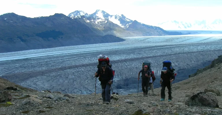
A must-do traverse for those who love multi-day routes and awe-inspiring landscapes. Four intense days crossing open grasslands, streams, rivers, and glaciers — reaching up to 1,500 m above sea level — to witness the immensity of the Southern Patagonian Ice Field.
⚠️ Important: This traverse travels through an area of Los Glaciares National Park designated as a Remote Area. Some mountain experience is essential. Trails are not marked in the same way as the main trail network (Laguna de los Tres, Laguna Torre, etc.), and there are no nearby medical services or serviced campsites.
Use the information below as a reference only. Before setting out, visit the Ceferino Fonzo Visitor Center for up-to-date information on the route and recommended gear.
Mountain Use Registration – Remote Areas, Los Glaciares National Park:
- Independent visitors: click here.
- Independent guides or service providers: click here.
Day 1: El Chaltén – Campamento Toro
Total distance: 17 km
Hiking time: Approx. 6 hours.
Elevation gain: 250 meters.
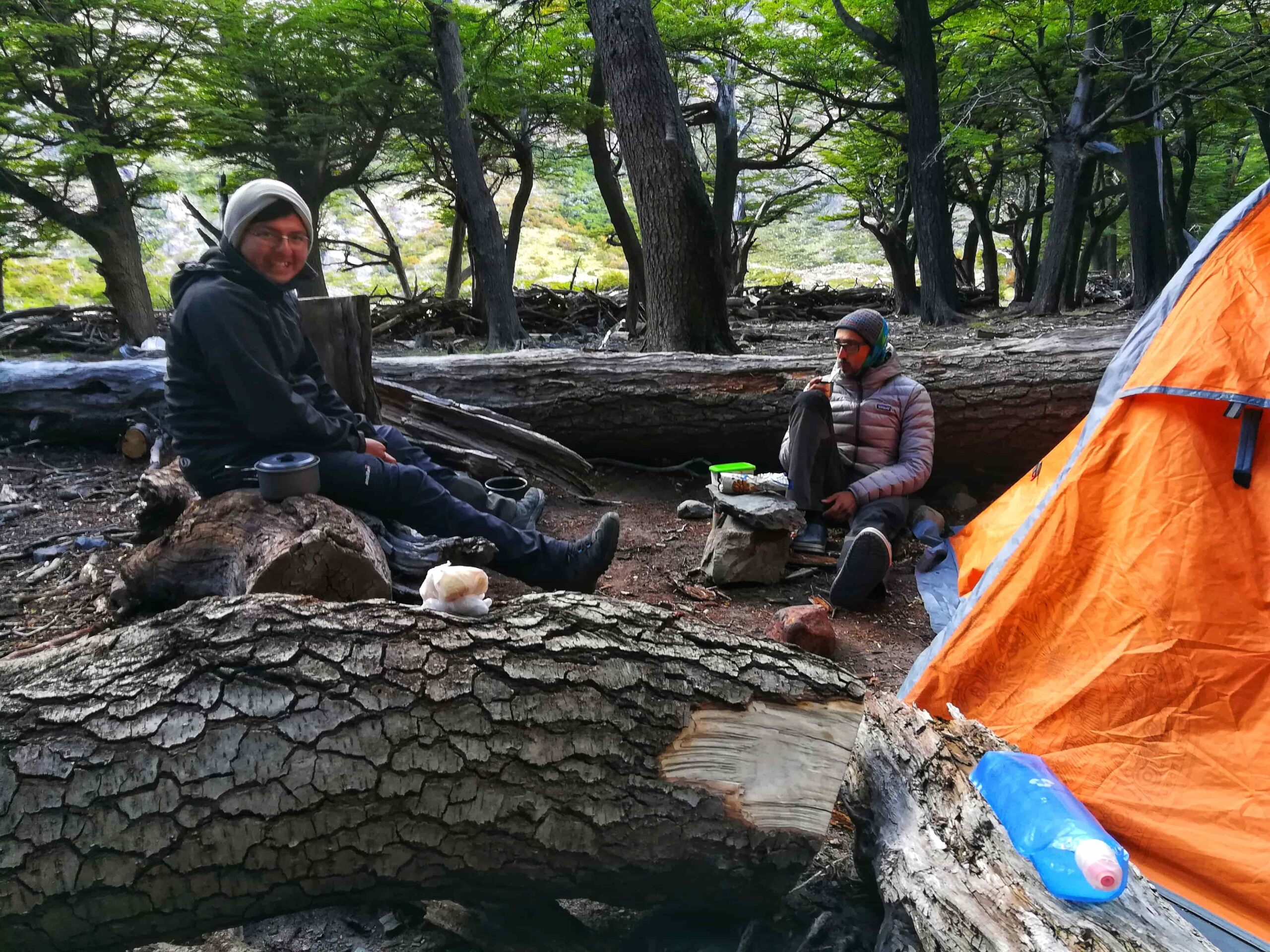
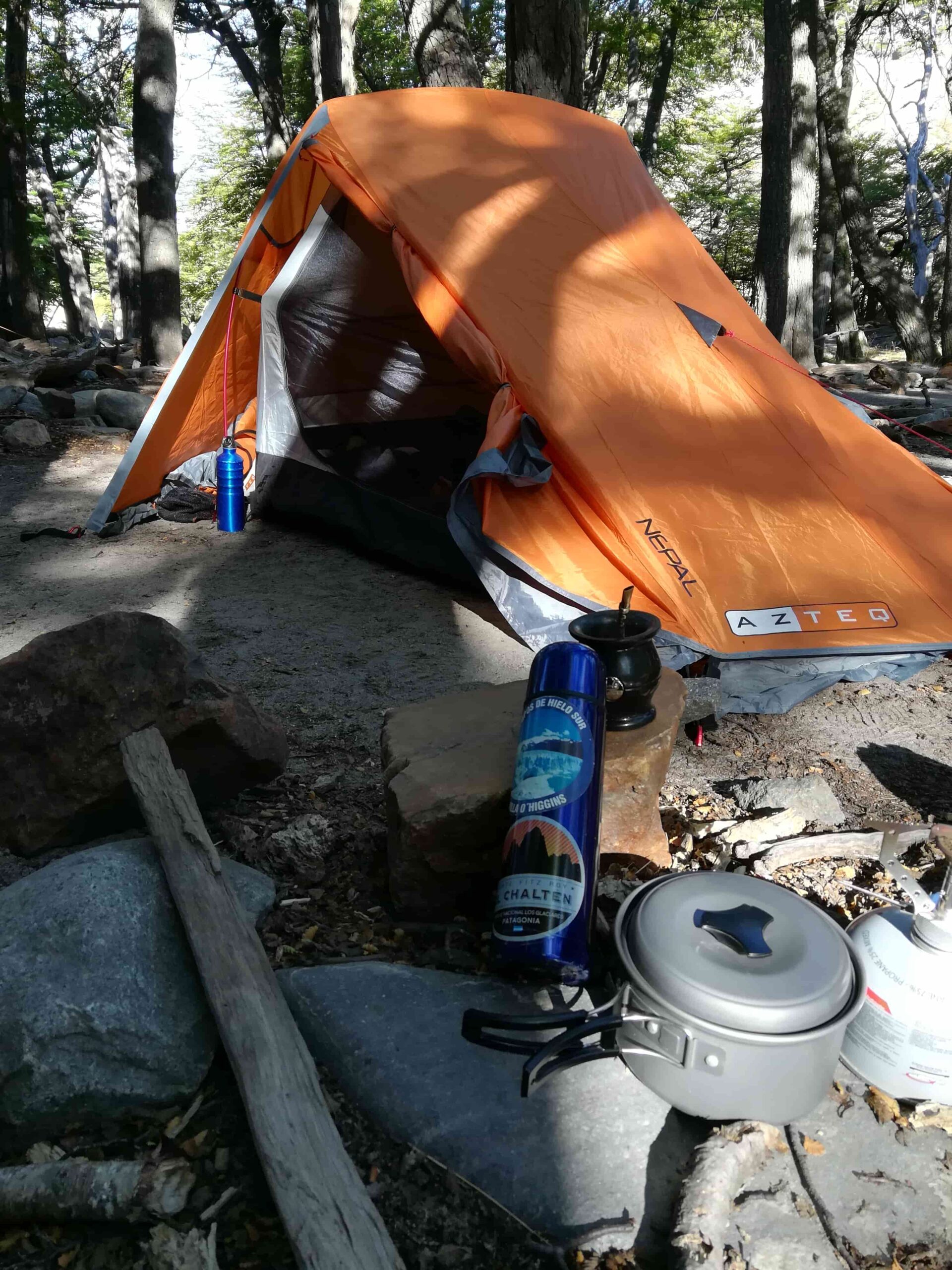
Overnight: Campamento Toro.
From El Chaltén, follow the trail toward Lago Toro. Throughout the day, beautiful views of Lago Viedma accompany you as you cross several streams — some with small log bridges — heading toward the Río Túnel valley. With no major difficulties, you’ll arrive at the first camp.
Day 2: Camp. Toro – Refugio Paso del Viento
Total distance: 14 km
Hiking time: Approx. 8-9 hours.
Elevation gain: 900 meters.
Overnight: Campamento / Refugio Paso del Viento.
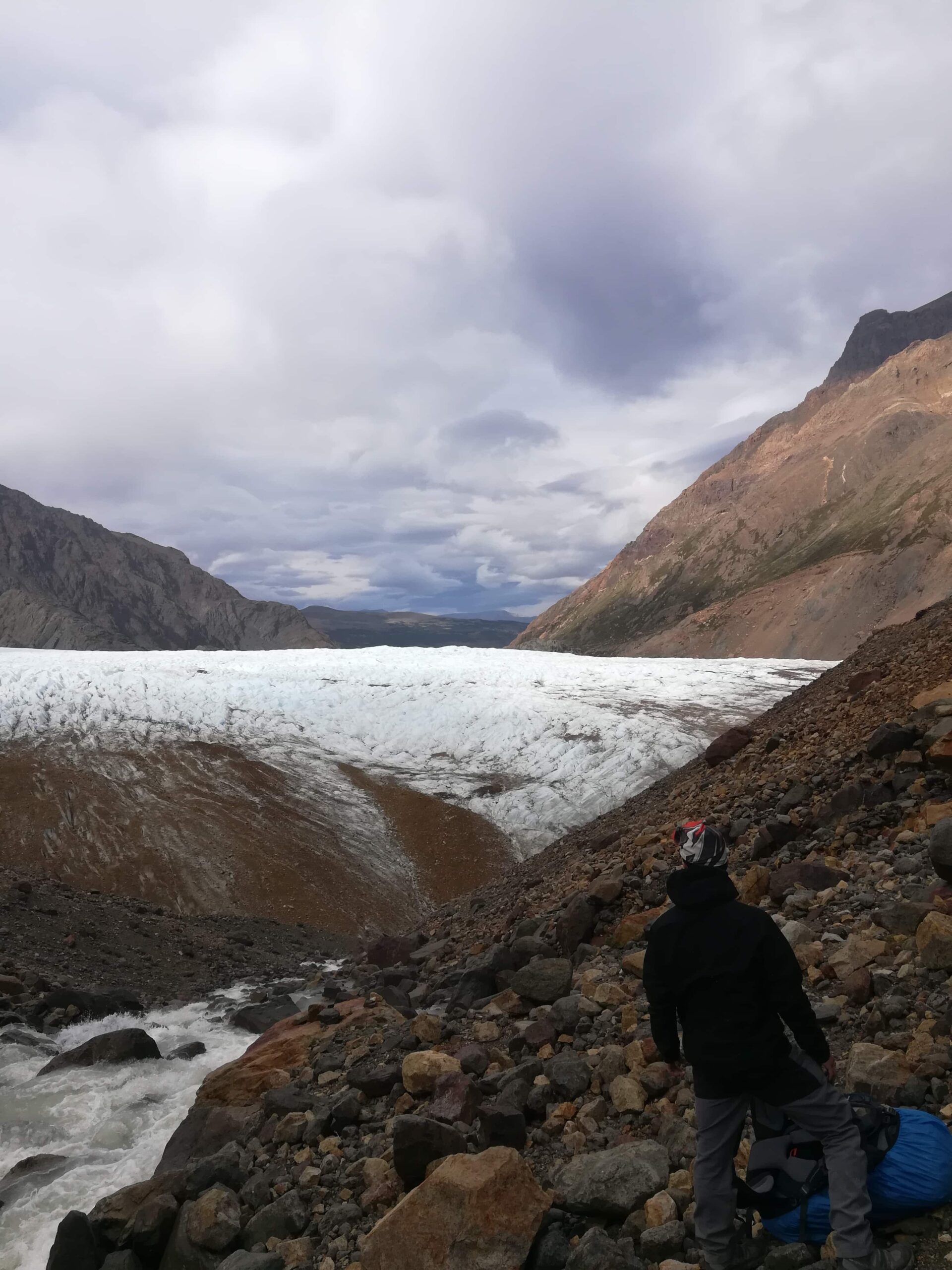
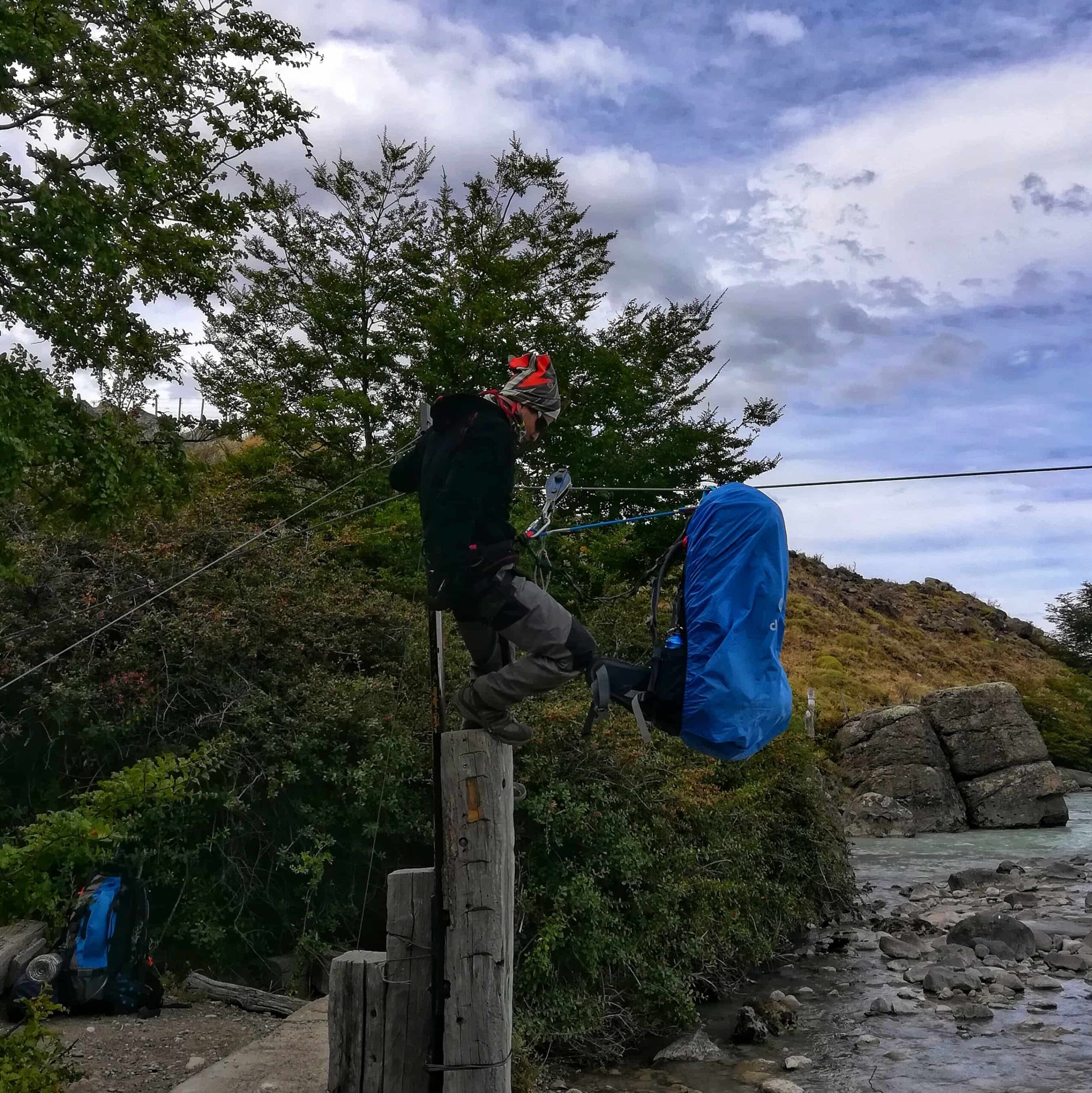
A long and demanding day. Leaving camp along the right bank, the ascent begins and you cross the Río Túnel via the zip-line (tyrolean traverse) already in place. Continue toward the Túnel Inferior Glacier.
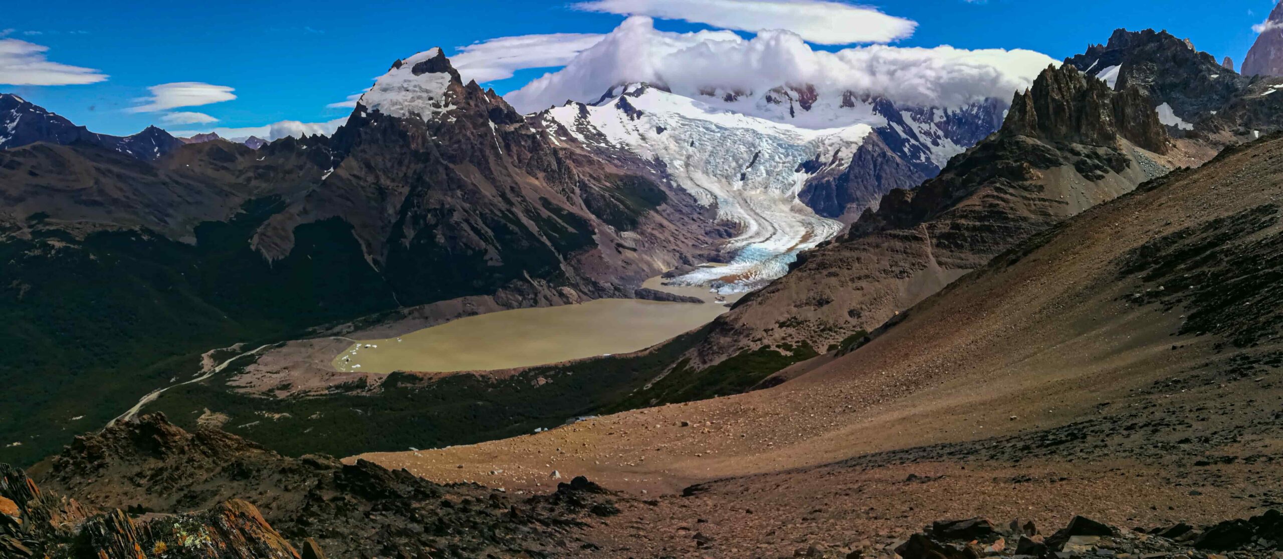
Important: This section is prone to rockfall and may have no visible trail. Move off the moraine bordering the glacier and advance carefully across the glacier itself — crampons are not required, but caution is essential. Descend from the glacier when crevasses begin to widen significantly and rejoin the trail along the lateral moraine. (Reference photo: February 2024 — use as a guide only, as glaciers change year to year.)
Once at the top, look left for a bivouac shelter and the trail continuing toward Paso del Viento. From here, the views of the Southern Patagonian Ice Field are simply extraordinary.
The descent follows the left-hand path down to Refugio Paso del Viento.
Day 3: Refugio Paso del Viento – Camp. Bahía de los Témpanos
Total distance: 17 km
Hiking time: Approx. 6-7 hours.
Elevation gain: 150 meters.
Overnight: Campamento Bahía Túnel.
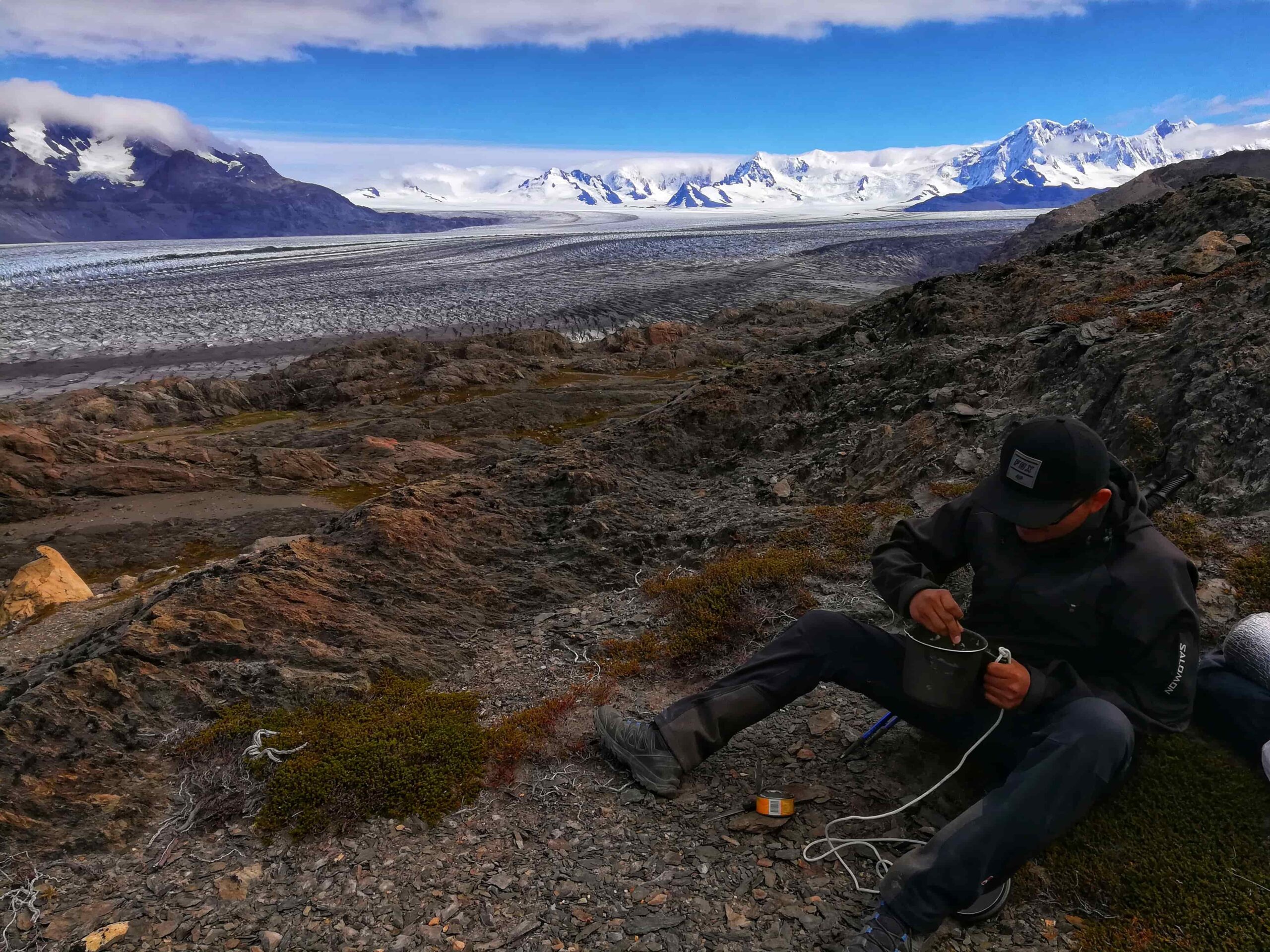
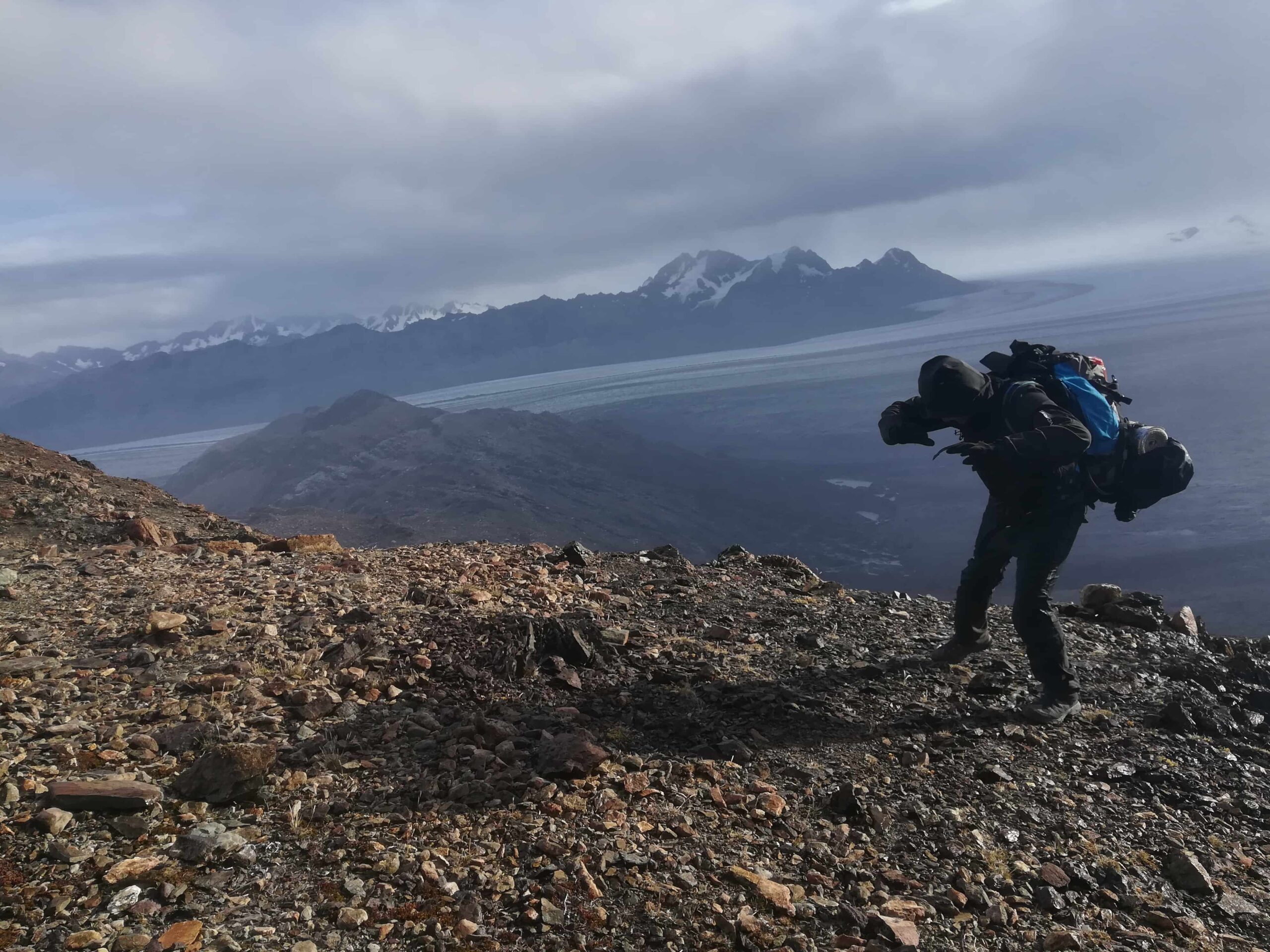
Another demanding day, though shorter than the previous one. After breaking camp, head south with Lago Viedma to your right and begin the ascent to Paso Huemul — from here, the full scale of the ice field reveals itself.
Important: The descent toward Bahía de los Témpanos is very steep. Take great care to avoid accidents.
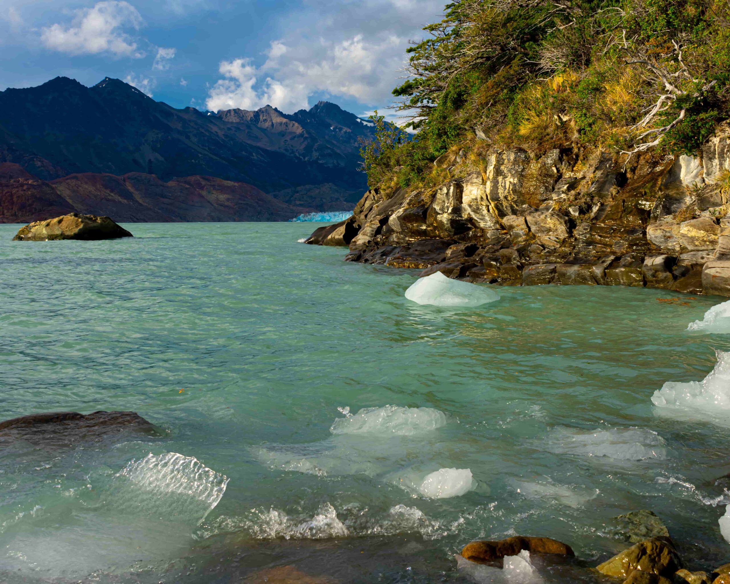
You’ll arrive at Bahía de los Témpanos, where the first glimpses of the Viedma Glacier come into view.
Day 4: Camp. Bahía de los Témpanos – El Chaltén
Total distance: 18 km (to Bahía Túnel) / 24 km (to El Chaltén on foot)
Hiking time: Approx. 6 hrs (to Bahía Túnel) / 9 hrs (to El Chaltén on foot)
Elevation gain: 50 meters.
Overnight: El Chaltén.
The final day of the traverse. The route covers mostly open steppe with low-lying vegetation. After 4–5 hours, you’ll cross the Río Túnel once more via the tyrolean traverse, and approximately 2 hours later arrive at Estancia Río Túnel.
From here, there are two options to return to the village:
- Arrange a transfer to meet you at the bay and drive you back to town. (Check availability — discount available with code trekkingelchalten25).
- Continue on foot toward the El Chaltén (estimated 3 additional hours on flat terrain).
Total distance: 70 km (full circuit).
Estimated time: 4 days and 3 nights.
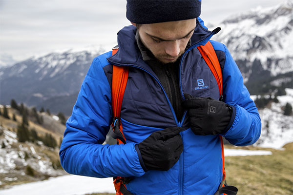
See: Recommended gear for multi-day treks and traverses
See: What to wear for hiking in El Chalten?
For the tyrolean traverses, the following gear is required as a minimum:
- 1 Harness.
- 1 locking steel carabiner.
- 1 locking aluminum carabiner.
- 1 quickdraw or daisy chain.
- 35 meters of 3–4 mm accessory cord (for retrieving the pulley).
Additionally:
- VHF radio loaded with the following frequencies:
- RX 150.395
- RX 150.395 // TX 155.135 (RPT El Chaltén)
- GPS device or offline-capable navigation app (we recommend Maps.me).
- Topographic map and compass (store the map in a waterproof bag).
On the traverse:
- Complete the traverse in a group of at least 2 people. If you lack experience, hiring a certified guide is strongly recommended.
- Cold temperatures drain batteries faster — this is why carrying a physical map and compass is so important.
- Check the weather forecast and aim for a stable weather window — especially for Days 2 and 3, which have the highest exposure.
- For glacier crossings: glaciers are living, ever-changing environments. Use common sense when getting on and off the ice — don’t rely entirely on the track. Always be aware of crevasses.
- Extra tip: to better distribute weight, try clipping your pack to the shoulder straps of your harness.
- For the tyrolean traverse: consider carrying an extra carabiner to clip your pack directly to the cable and drag it across.
- Arrange a transfer for the return to town and spare yourself 3 extra hours of walking (Check availability).
On the environment:
- Pack out all waste. If you carried in kilos of food, you can certainly carry out the wrappers and peels — they weigh almost nothing.
- Solid waste must be buried; toilet paper goes into a small bag and must be packed out to the village.
- Washing up: use a container to collect water and move at least 50 paces away from any stream or river. Avoid contaminating water sources — no soaps or chemical products. A hot shower can wait until you’re back in town.
- Fire is strictly prohibited throughout the national park. Use a camp stove for cooking, and only in designated areas.
Before heading out, always check the weather forecast. Depending on the time of year and the type of route, we also recommend verifying sunrise and sunset times.
We recommend the following apps (desktop versions also available):
- WINDY.COM: Ideal for checking wind speed and gust forecasts.
- YR.NO: Best for temperature and precipitation data.
For more information on weather and alternative apps: click here.
MAP
Max elevation: 1436 m
Min elevation: 262 m
📱 Download the track: The GPX and KML track files are available through our Premium Web Portal. For more information: click here.
⚠ Important: Use this track as a reference only — it may contain errors. Always follow official park signage, and when in doubt, consult Los Glaciares National Park staff.
🚗 Transfer Service: To avoid the long walk back from the bay, we recommend arranging a transfer in advance. Check availability here.
🔉 Guided service: We do not offer guided hikes directly, but we are in contact with independent certified guides. If you need this service, please send us a message!

PHOTOS AND VIDEOS