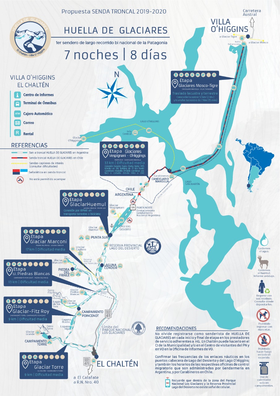
HUELLA DE GLACIARES TRAIL
A lesser-known traverse, but breathtaking in every sense. Over 8 days and 7 nights, you’ll encounter glaciers, lakes, mountains, and vast stretches of ancient forest. This traverse connects the village of El Chaltén (Argentina) with Villa O’Higgins (Chile) and can be completed in either direction.
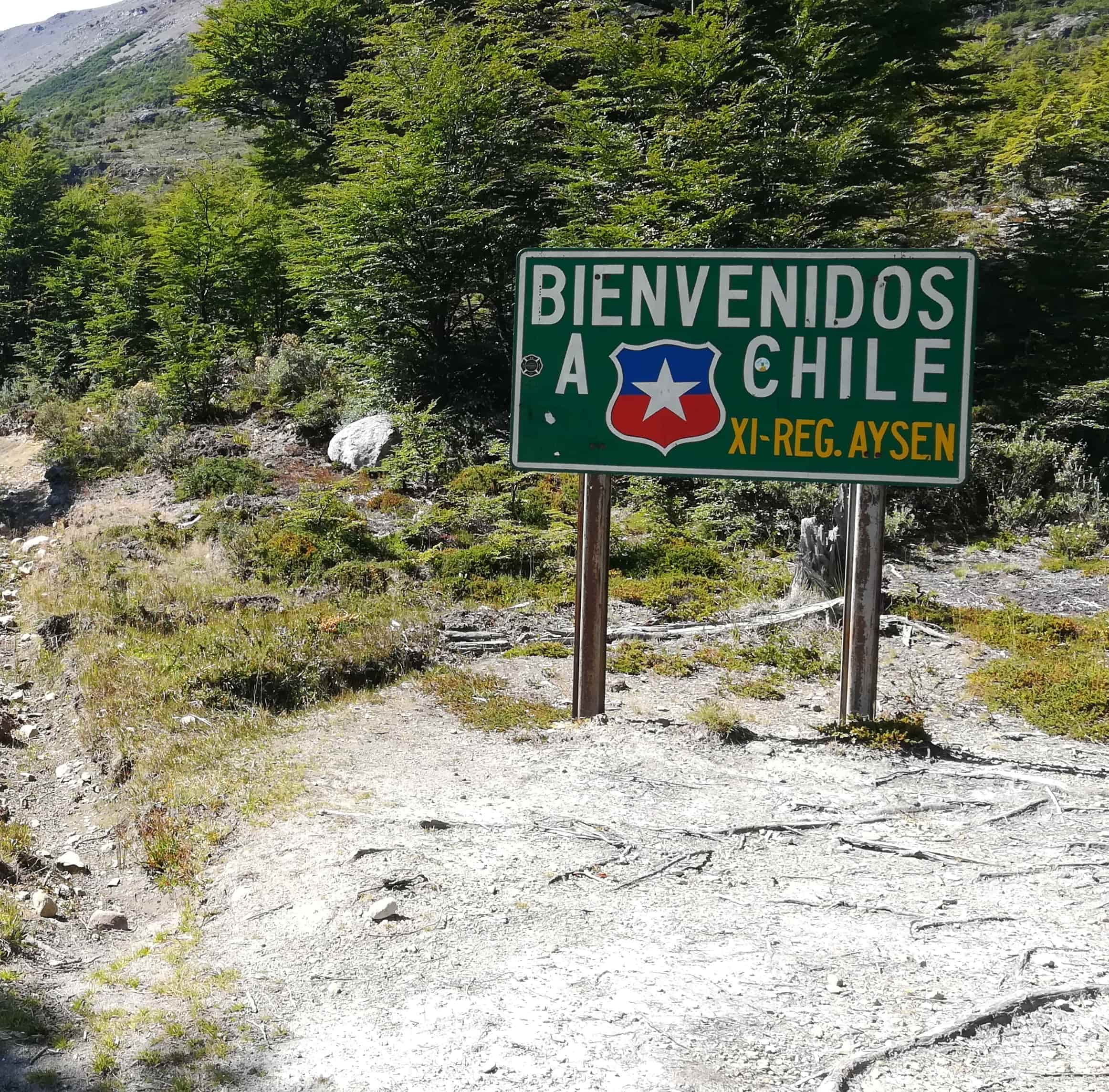
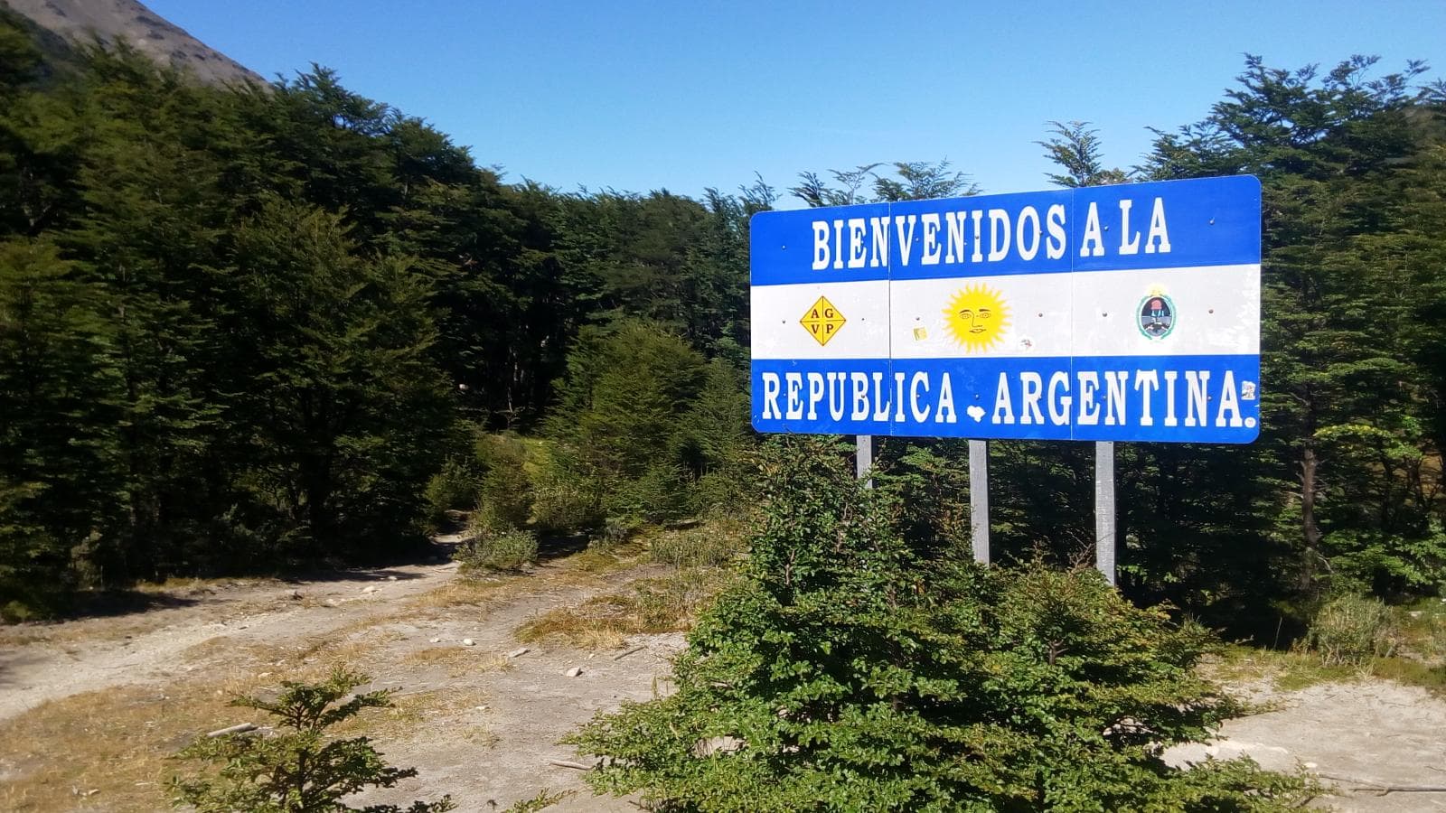
⚠️ Important: This is a binational traverse. Border crossing formalities must be completed both upon entering Chile and upon returning to Argentina.
Note 1: Advance booking of transfers and lake crossings is essential — particularly for the Lago O’Higgins crossing, and optionally for a transfer from the Río Eléctrico bridge to the southern tip of Lago del Desierto to save time.
Note 2: The provided track covers the main route only. We encourage hikers to allow extra time and explore as many side routes and points of interest as possible along the way.
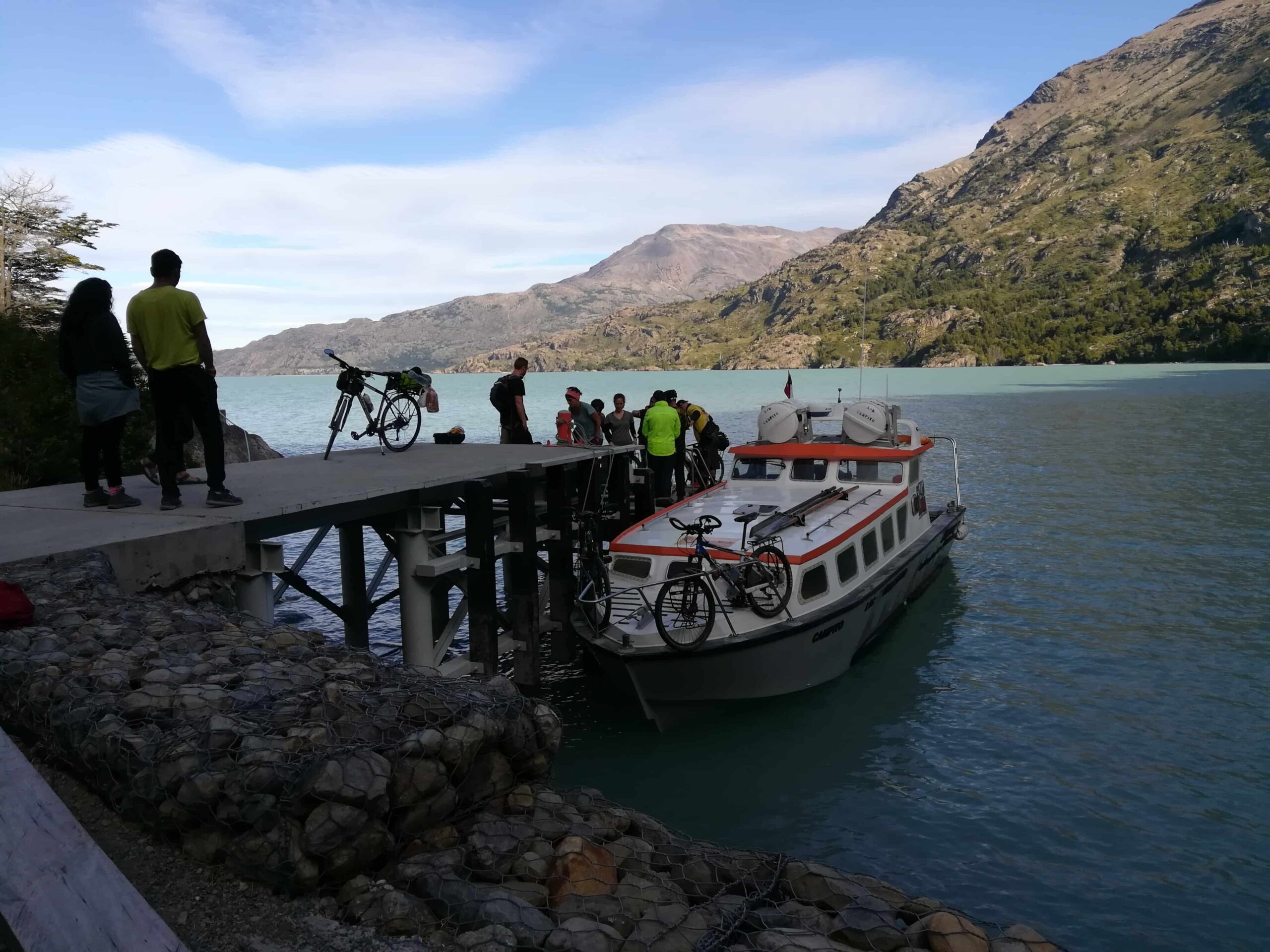
Note 3: The track runs along the shore of Lago del Desierto, but a boat crossing can also be arranged. Horses or 4×4 vehicles can likewise be hired for the Punta Norte – Candelario Mansilla section.
Use the information below as a reference only. Before setting out, visit the Ceferino Fonzo Visitor Center (El Chaltén) or the Information Center (Villa O’Higgins) for up-to-date route conditions
Stage 1: Torre Glacier
This stage begins on the Laguna Torre trail and ends at Campamento De Agostini.
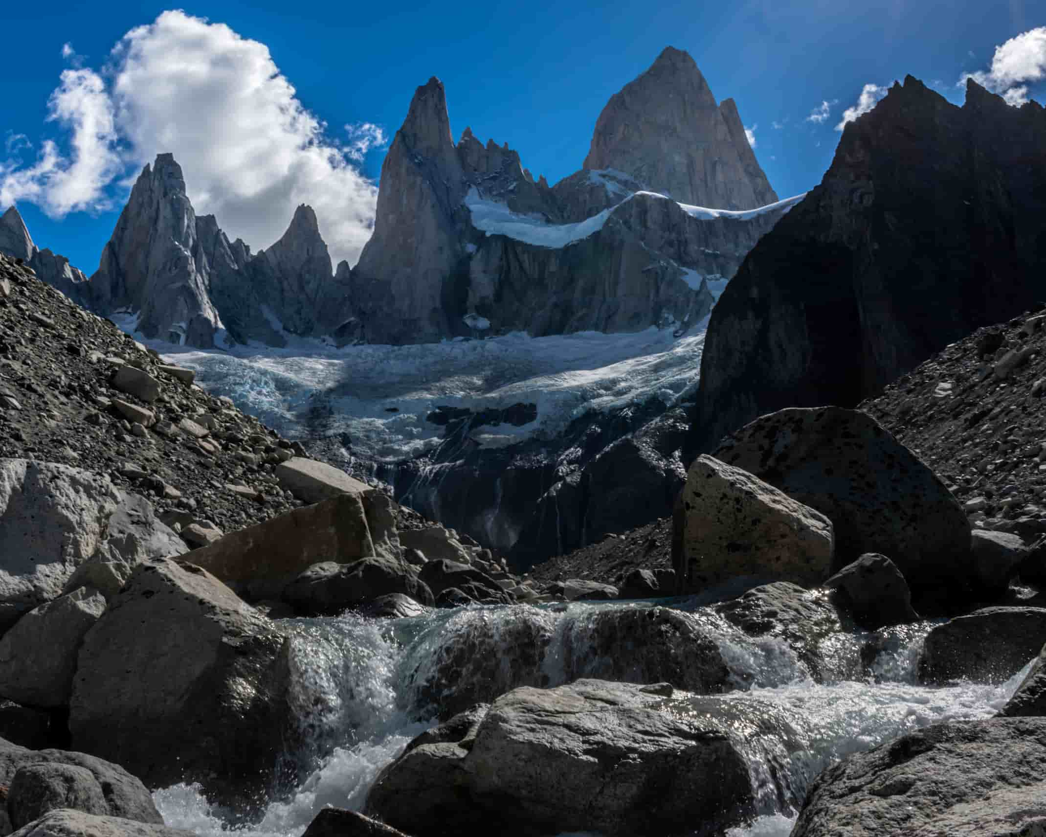
At the end of this stage, you’ll have sweeping views of Cerro Solo, Cerro Grande, Cerro Adela, Cerro Torre, and their respective glaciers.
Stage 2: Fitz Roy Glacier
This stage begins at Campamento De Agostini and ends at Campamento Poincenot.
The two camps are connected via the Madre e Hija trail (approximately 9 km), with an ascent in the first section.
From Poincenot, you can tackle the climb to Laguna de los Tres (more info: Laguna de los Tres).
Stage 3: Piedras Blancas Glacier
This stage begins at Campamento Poincenot and ends at Refugio Piedra del Fraile.
Leaving Poincenot, follow the trail toward Estancia El Pilar, where midway along the route you’ll catch views of the Piedras Blancas Glacier.
From El Pilar, continue along the gravel road to the bridge and connect with the trail leading to Refugio Piedra del Fraile (more info: Paso del Cuadrado).
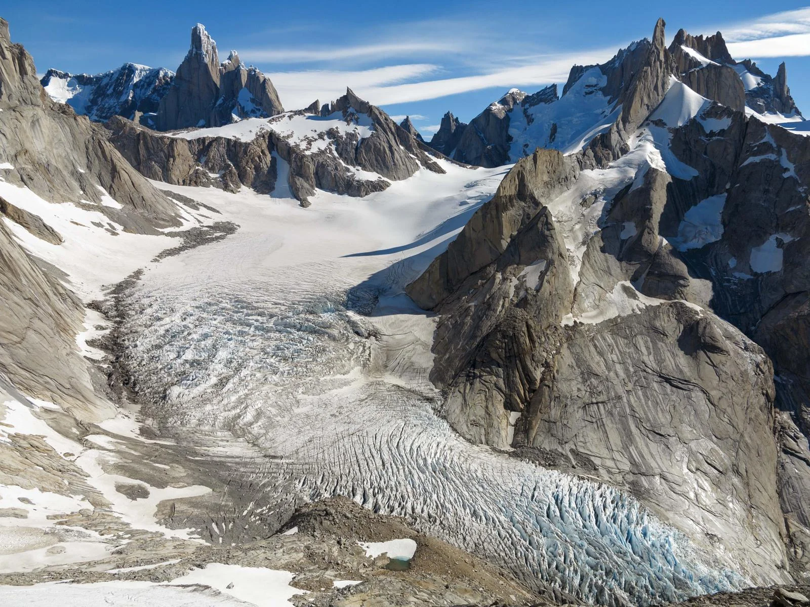
Stage 4: Marconi Glacier – Huemul Glacier
This stage begins at Refugio Piedra del Fraile and ends at the southern tip of Lago del Desierto.
This section can be completed on foot, or you can arrange a transfer in advance from the Río Eléctrico bridge to the southern tip of Lago del Desierto — contact us to arrange your transfer!
There are several campsites and cabins along the way, and a side hike to the Huemul Glacier can also be done from this area.
Stage 5: Vespignani Glacier
This stage begins at the southern tip of Lago del Desierto and ends at the northern tip of Lago del Desierto.
At this stage, you can choose between two options:
Lake crossing by boat — saves approximately one full day.
Hiking along the shoreline — approximately 6 hours of hiking over uneven but beautiful terrain
At the northern tip, you’ll find the Argentine Border Police (Gendarmería Argentina) post, where you can complete the immigration formalities required to enter Chilean territory, and make use of their campsite.
💡 Tip: If the weather cooperates, it’s well worth waiting for the sunrise and looking back toward Fitz Roy.
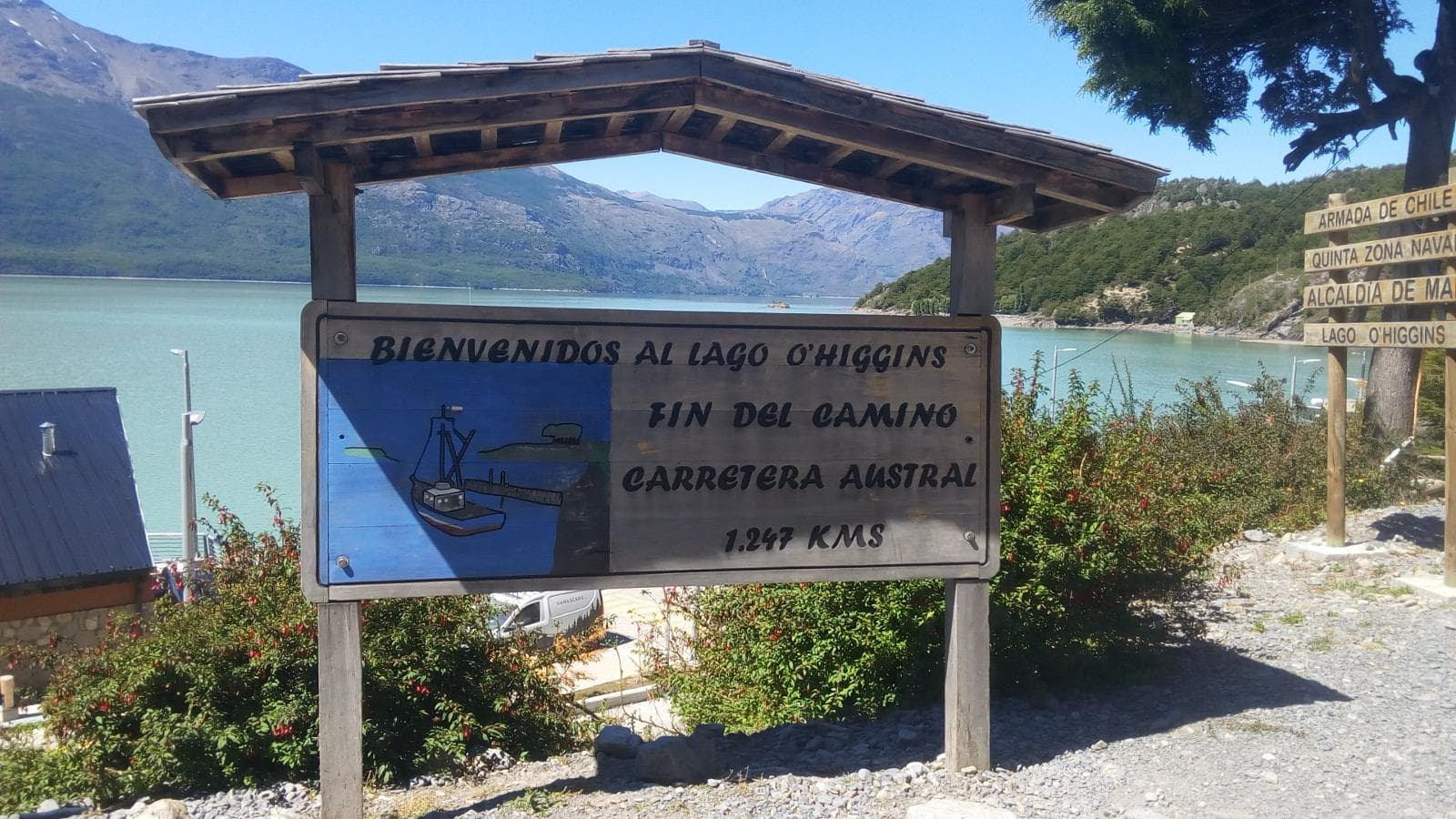
Stage 6: O’Higgins Glacier
This stage begins at the northern tip of Lago del Desierto and ends at Candelario Mansilla.
Likely the longest stage of the entire traverse. The route starts at Gendarmería Argentina and ends at Candelario Mansilla, passing through the border marker (Hito Fronterizo) and completing immigration formalities with the Chilean Border Police (Carabineros de Chile). Depending on fitness, this stage takes between 7 and 8 hours.
At Candelario Mansilla, you can camp, eat, and rest before catching the next day’s ferry.
Useful contacts (Candelario Mansilla):
Ricardo Levican (campsite owner): [email protected] / +569-75113082 / +569-93162011
Lago O’Higgins crossing: Ruedas de la Patagonia
Port status check: Chilean Port Conditions (Lago General Carrera section).
Stage 7: Mosco Glacier & Tiger Glacier
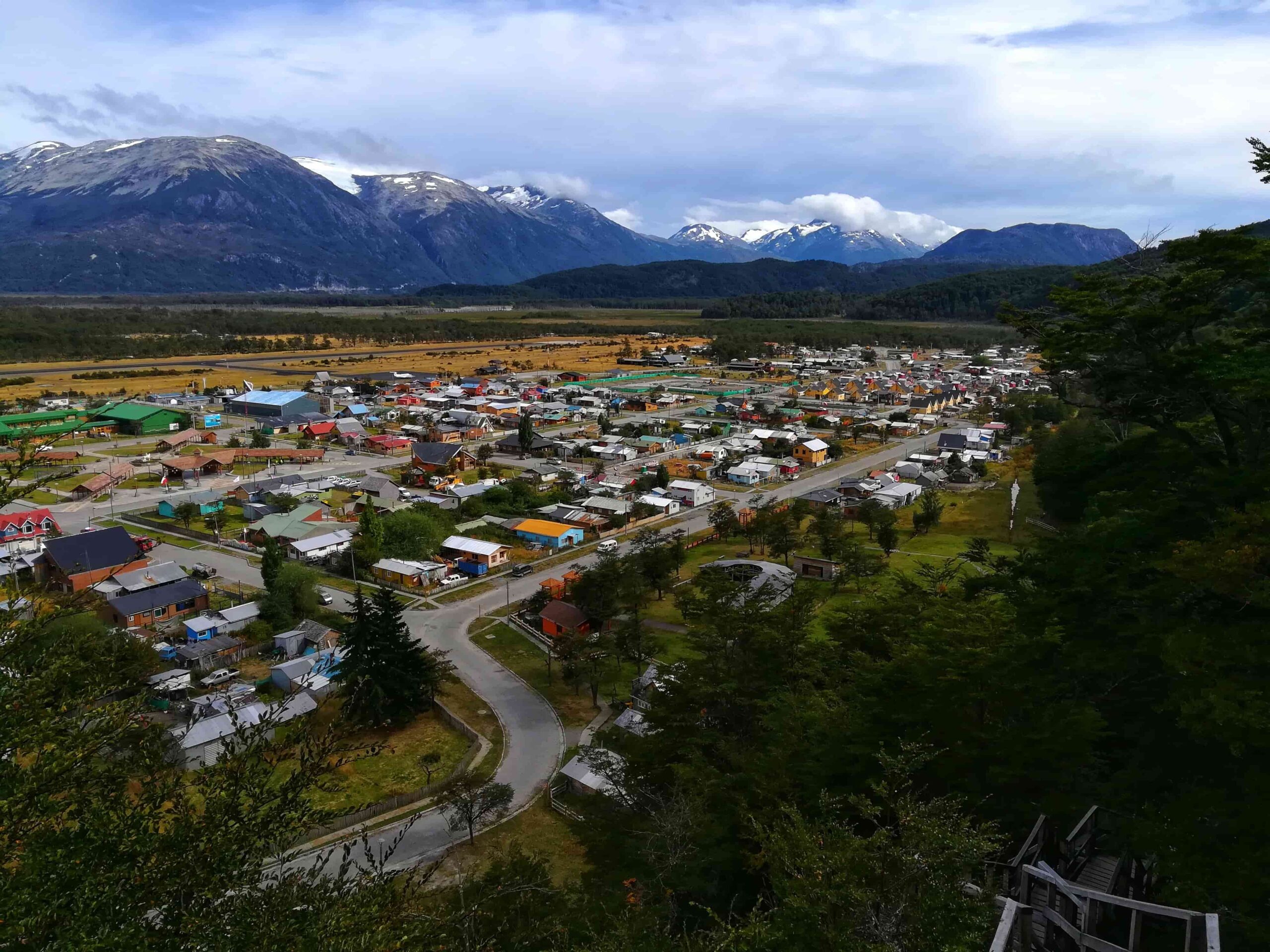
This stage begins at Candelario Mansilla and ends at Villa O’Higgins.
The final stage of the traverse begins with the Lago O’Higgins boat crossing — advance reservation is essential, as departures are weather-dependent and don’t run daily. The crossing can also be combined with a visit to the O’Higgins Glacier (book well in advance).
Upon arrival at Puerto Bahamondes, a transfer can be taken to Villa O’Higgins.
Useful contacts (Villa O’Higgins):
“El Mosco” Camping & Accommodation: Instagram
Not to be missed: Glaciar El Mosco Park
Total distance (main route):136 km (additional side routes may extend the traverse).
Estimated time: 8 days and 7 nights.
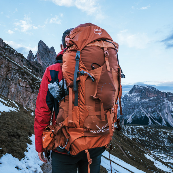
About the equipment:
See: Recommended gear for multi-day treks and traverses.
See: What to wear?
On the traverse:
- Planning is everything. Before setting out, map out your itinerary in full and plan your food supply and transfers accordingly.
- Resupply points: To reduce pack weight, supplies can be purchased at the southern tip of Lago del Desierto, Refugio Piedra del Fraile, and Candelario Mansilla.
- Río Eléctrico – Lago del Desierto transfer: Must be booked in advance and schedules must be respected. If you miss your transfer, you’ll need to walk the full 20 km — likely adding an extra day. Use our Transfer section and we’ll help you out.
- Lago O’Higgins crossing: Book well in advance. Departures are cancelled in high winds — the same applies to Lago del Desierto.
On the environment:
- Pack out all waste. If you carried in kilos of food, you can certainly carry out the wrappers and peels — they weigh almost nothing.
- Solid waste must be buried; toilet paper goes into a small bag and must be packed out.
- Washing up: use a container to collect water and move at least 50 paces away from any stream or river. No soaps or chemical products — a hot shower can wait until you’re back in town.
- Fire is strictly prohibited throughout the national park. Use a camp stove and only cook in designated areas.
Before setting out each day, always check the weather forecast. Given the duration of this traverse, check conditions whenever possible — Refugio Piedra del Fraile and Gendarmería Argentina can also provide useful multi-day weather updates.
We recommend verifying sunrise and sunset times and using the following apps:
WINDY.COM — Ideal for checking wind speed and gust forecasts.
YR.NO — Best for temperature and precipitation data.
For more information on weather and alternative apps: click here.

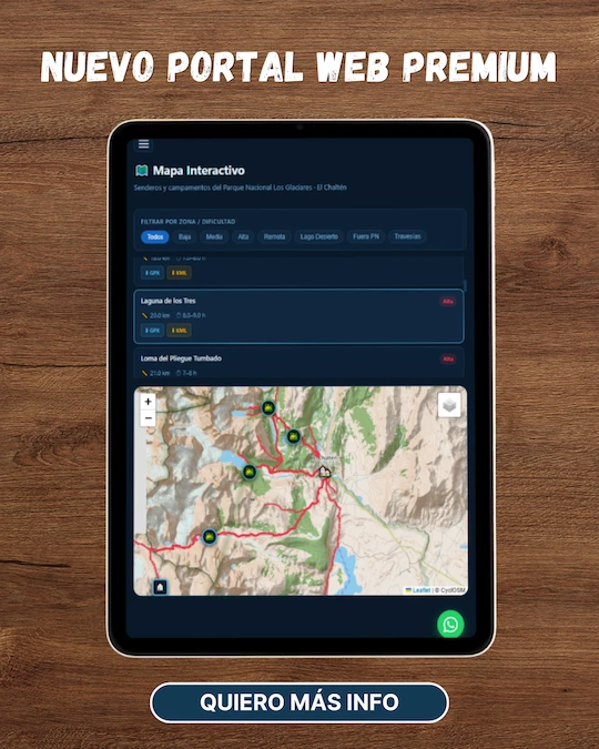
MAP
Max elevation: 775 m
Min elevation: 252 m
📱 Download the track: The GPX and KML track files are available through our Premium Web Portal. For more information: click here.
⚠ Important: Use this track as a reference only — it may contain errors. Always follow official park signage, and when in doubt, consult Los Glaciares National Park staff.
🔉 Guided service: We do not offer guided hikes directly, but we are in contact with independent certified guides. If you need this service, please send us a message!
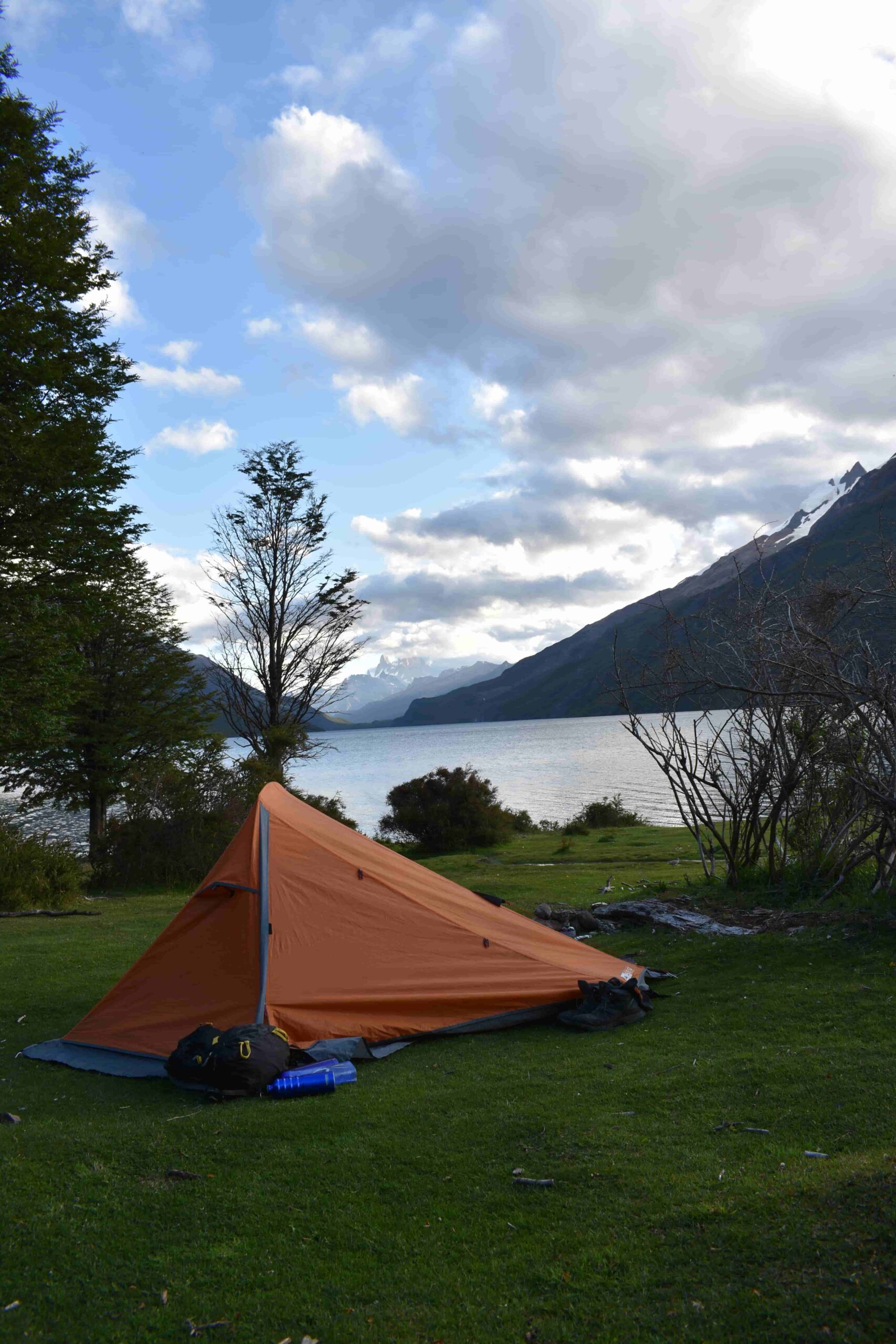
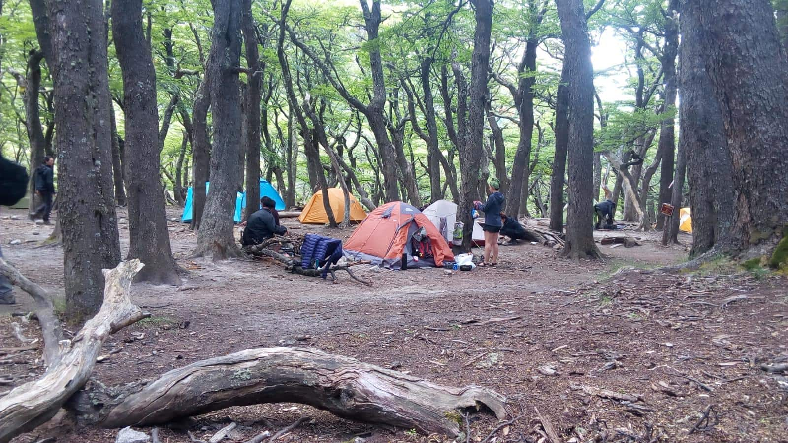
PHOTOS AND VIDEOS