LAGUNA DE LOS TRES - LAGUNA TORRE TRAVERSE
Quite possibly the most popular traverse in the area. Over 3 days and 2 nights, you’ll connect El Chaltén’s two iconic destinations: Laguna de los Tres and Laguna Torre.
Note:This traverse starts and ends in El Chaltén. It’s also possible to begin directly from the Río Eléctrico bridge.
Day 1: El Chaltén to Laguna de los Tres – Camp. Poincenot
Total distance: 14 km
Hiking time: Approx. 7 hours
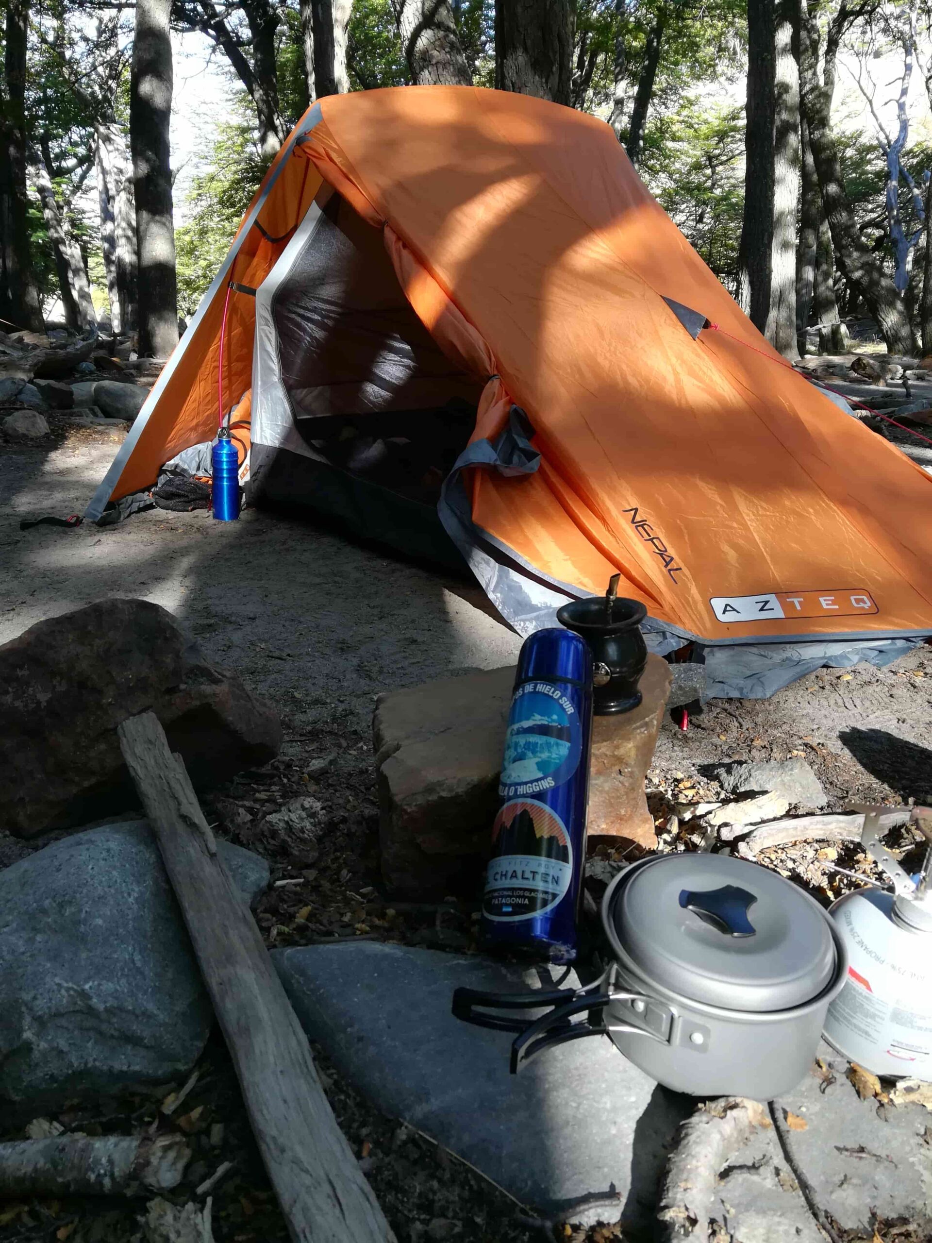
Overnight: Camp Poincenot
The trail begins at the northern end of Av. San Martín and is clearly marked with official Los Glaciares National Park signage.
The route gradually ascends for approximately 3 km until reaching a trail junction, where you can choose:
-
A) Visit Laguna Capri, where you can also rest, use the toilet facilities, or overnight (left fork)
-
B) Head to the Fitz Roy Viewpoint (right fork)
Both options reconnect further along the trail.
At approximately km 7, you’ll reach the Madre e Hija trail junction — the connecting trail to Laguna Torre (you’ll pass this way again tomorrow). Turn right and continue to Campamento Poincenot.
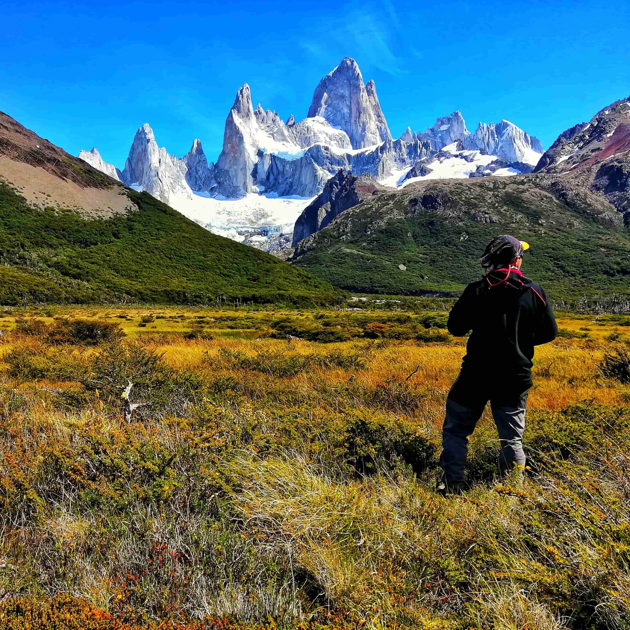
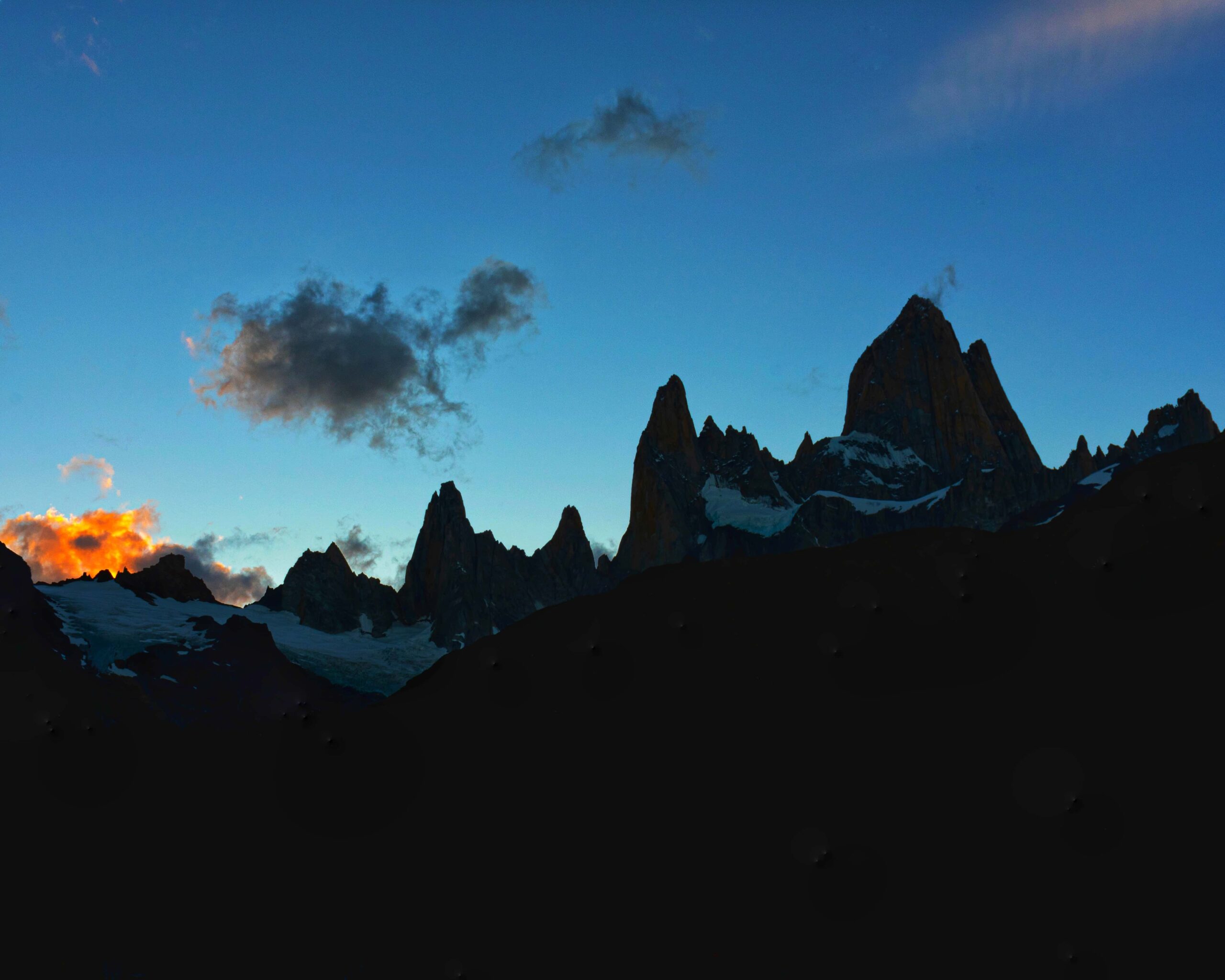
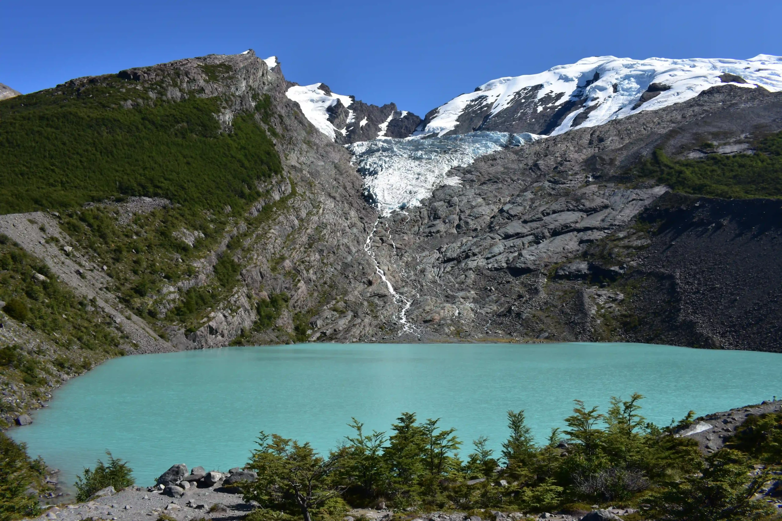
After setting up camp, having something to eat, and resting, cross the footbridge and tackle the famous summit approach to Laguna de los Tres. Depending on your fitness level and energy, this section will take between 1 and 2 hours — but every step is worth it. Soon you’ll be gazing at the turquoise waters of the lake with the legendary Mount Fitz Roy (Cerro Chaltén) rising behind it.
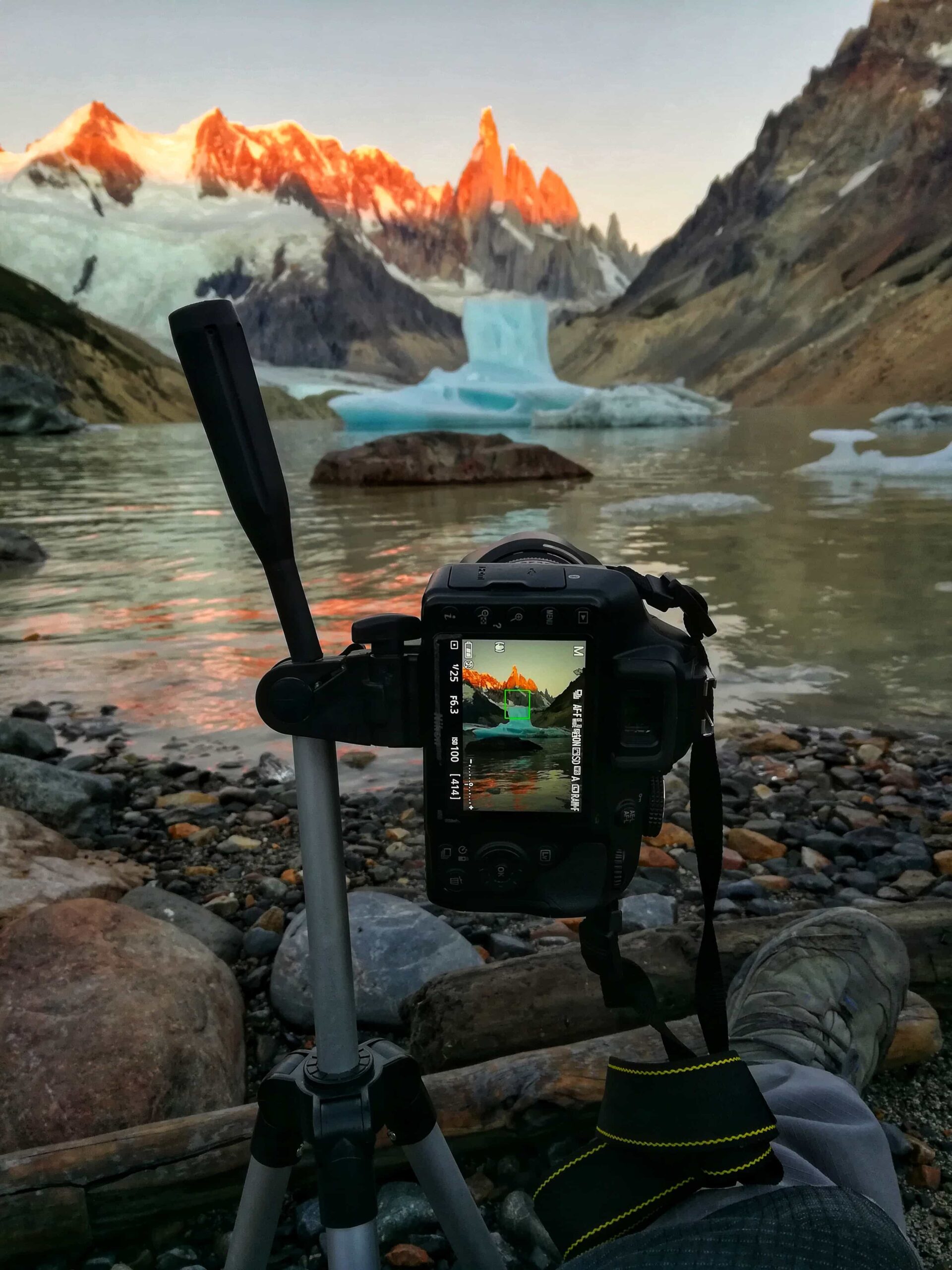
Tip: If the weather cooperates, make the extra effort to catch the sunrise from the lake. Check the exact sunrise time (see the “Recommendations” tab) and set out from Poincenot about 2 to 2.5 hours before dawn — no need to rush.
Day 2: Camp. Poincenot – Madre e Hija junction – Laguna Torre – Camp. DAgostini
Total distance: 14 km
Hiking time: Approx. 5 hours
Overnight: Camp De Agostini
After a good breakfast, retrace your steps to the junction that connects with the Madre e Hija trail toward Laguna Torre.
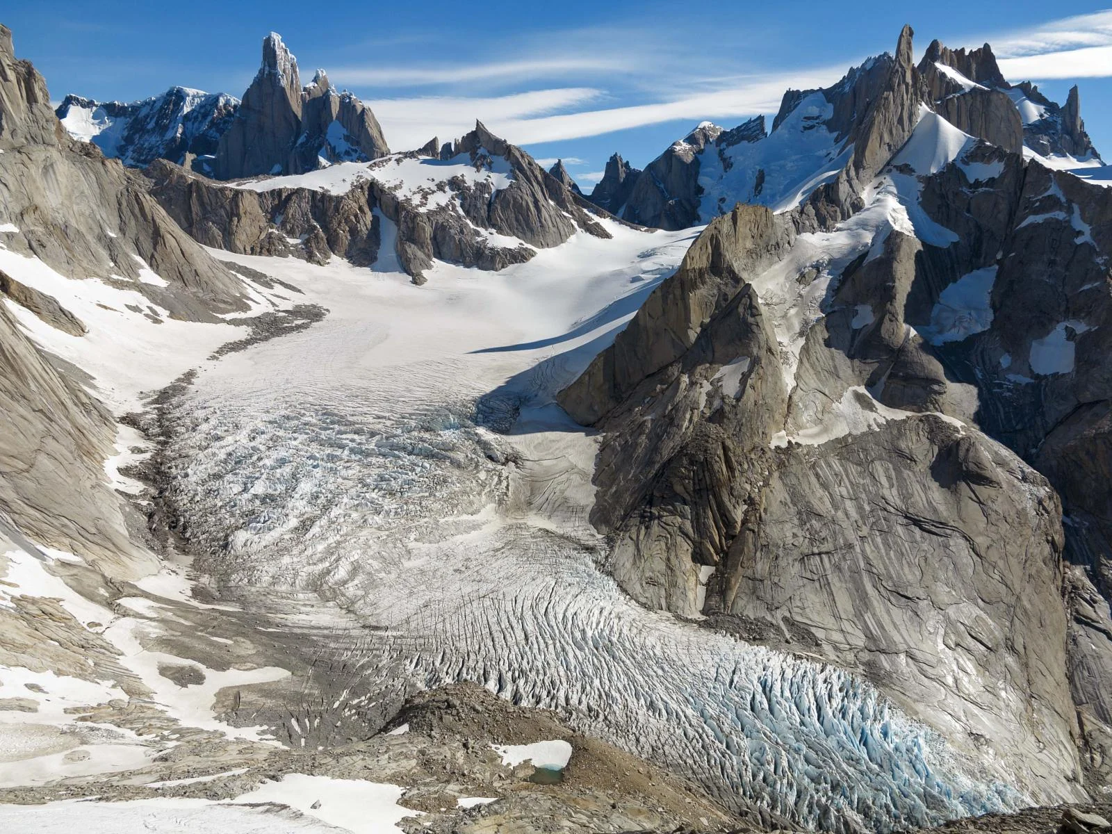
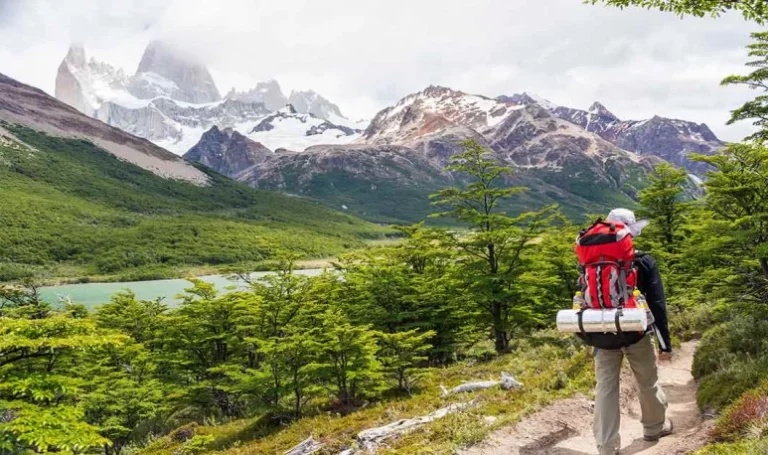
The trail winds for approximately 3 hours through a scenic corridor with views of Laguna Madre (the larger lake) and Laguna Hija (the smaller one). The route is nearly flat throughout, with several side paths leading down to the lakeshore — perfect spots to pause and take in the landscape you’re leaving behind.
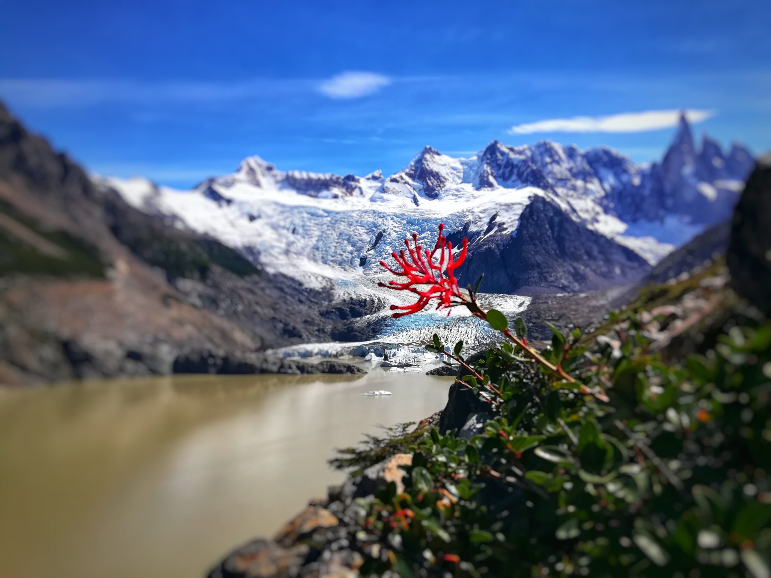
Once you connect with the Laguna Torre trail, take the turnoff to Campamento D’Agostini, set up camp, and continue a few more minutes to the lakeshore. From there, you can also follow the shoreline to Mirador Maestri for a closer, more dramatic view of Cerro Torre.
Tip 2: As with Day 1, catching the sunrise at Laguna Torre is highly recommended. Keep in mind: Cerro Torre can be elusive — cloud cover often obscures it, so check the forecast carefully. Setting out from D’Agostini just 30 minutes before sunrise is plenty of time.
Day 3: Camp. De Agostini – El Chaltén
Total distance: 8 km
Hiking Time: Approx. 3–4 hours
Overnight: El Chaltén
The last day of the traverse — unfortunately. Since the hike back only takes 3 to 4 hours, you’ll have plenty of time to make one last visit to Laguna Torre or simply find a quiet spot to sit and soak it all in before heading home.
On the way back, don’t miss the chance to linger at the Torre Viewpoint — it’s well worth one more stop.
Tip: Back in town, a well-earned cold pint of beer is practically mandatory. Cheers — you’ve earned it! 🍺
Total distance: 36 km (full circuit).
Estimated time: 3 days and 2 nights.
On the traverse:
- This traverse runs entirely within the main trail network of Los Glaciares National Park, so you’ll regularly cross paths with other hikers. Solo travelers: don’t hesitate to set out on your own.
- Campsites: These are backcountry campsites with no facilities other than basic toilet structures. There is no food for sale and no refuges. Everything goes up — and comes back down — with you.
- Mountain hikers are generally very respectful, but as a precaution, avoid leaving valuables unattended inside your tent.
- Keep noise to a minimum at camp — the sounds of nature are far better than any playlist.
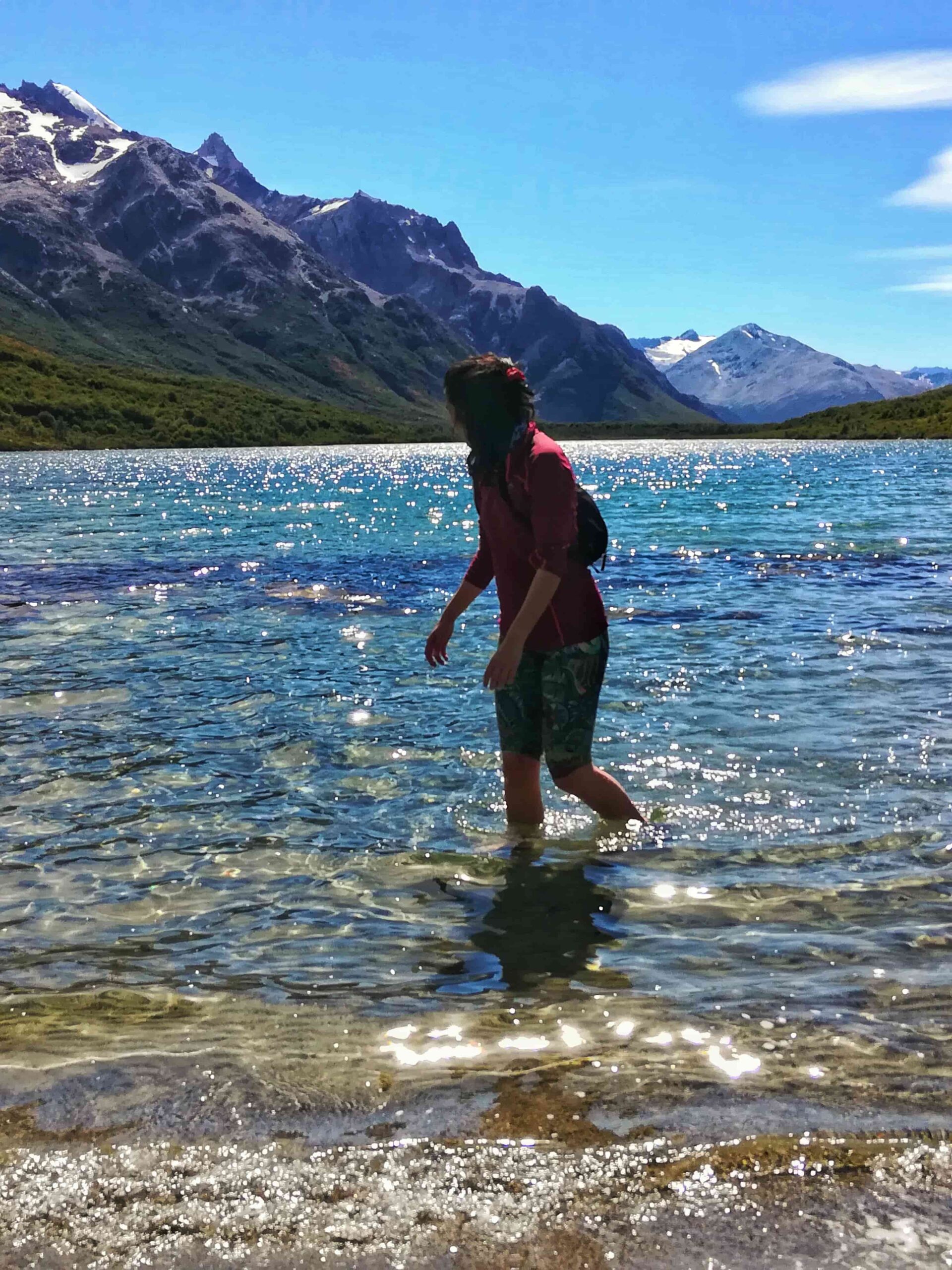
- Water: All water sources along the route are safe to drink.
Important: The water of the Río Fitz Roy (near Campamento De Agostini) has a slightly milky, sedimented appearance — but it is 100% safe to drink. - For sunrise hikes: Always set out with extra time, carry a headlamp with fresh batteries, and move carefully in the dark.
On the environment:
- Pack out all waste. If you carried in kilos of food, you can certainly carry out the wrappers and peels — they weigh almost nothing.
- Solid waste must be buried; toilet paper goes into a small bag and must be packed out to the village.
- Washing up: use a container to collect water and move at least 50 paces away from any stream or river. Avoid contaminating water sources — no soaps or chemical products. A hot shower can wait until you’re back in town.
- Fire is strictly prohibited throughout the national park. Use a camp stove for cooking, and only in designated areas.
Before heading out, always check the weather forecast. Depending on the time of year and the type of route, we also recommend verifying sunrise and sunset times.
We recommend the following apps (desktop versions also available):
- WINDY.COM: Ideal for checking wind speed and gust forecasts.
- YR.NO: Best for temperature and precipitation data.
For more information on weather and alternative apps: click here.
MAP
Max elevation: 1177 m
Min elevation: 401 m
📱 Download the track: The GPX and KML track files are available through our Premium Web Portal. For more information: click here.
⚠ Important: Use this track as a reference only — it may contain errors. Always follow official park signage, and when in doubt, consult Los Glaciares National Park staff.
🔉 Guided service: We do not offer guided hikes directly, but we are in contact with independent certified guides. If you need this service, please send us a message!
PHOTOS AND VIDEOS